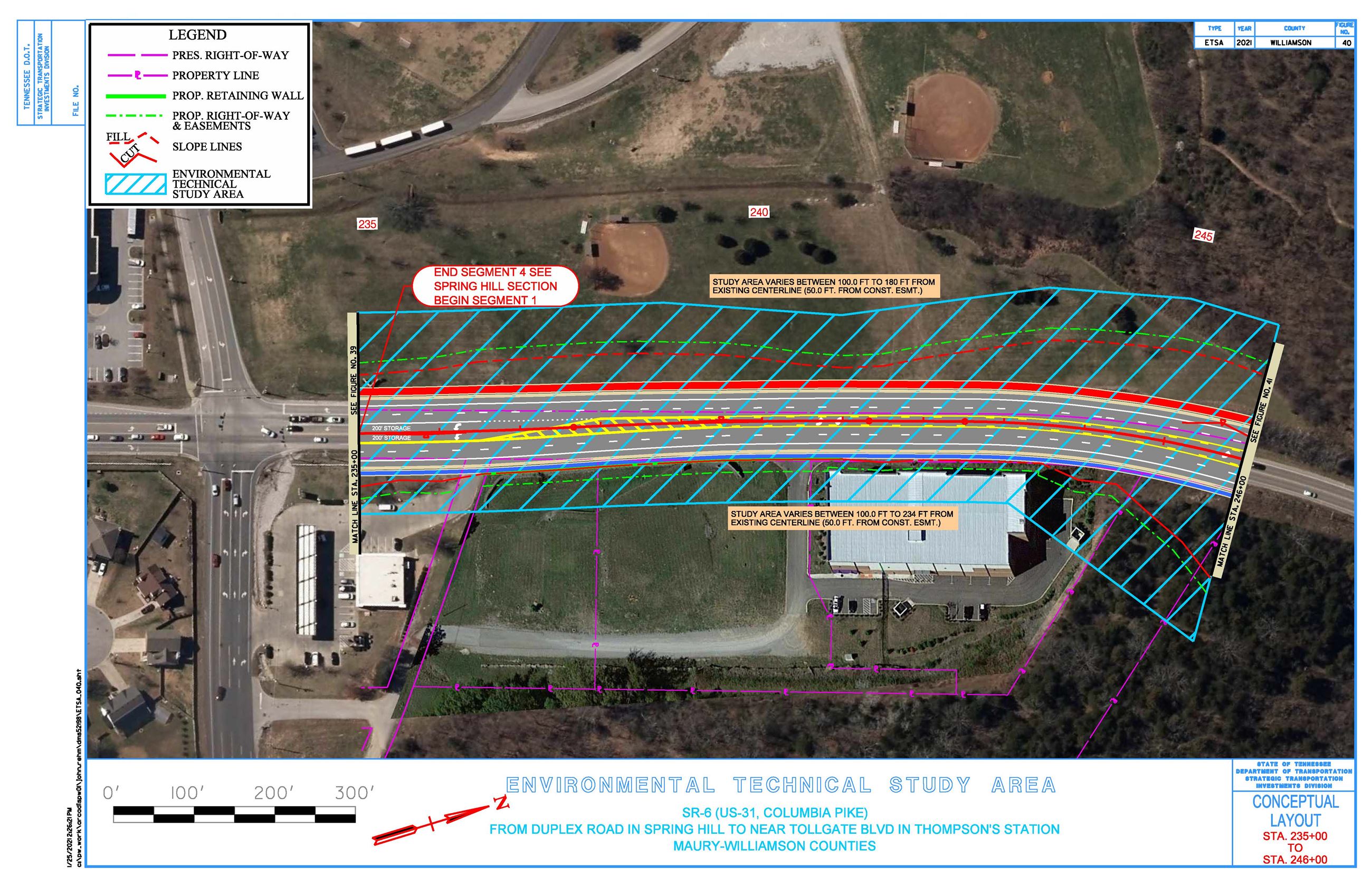
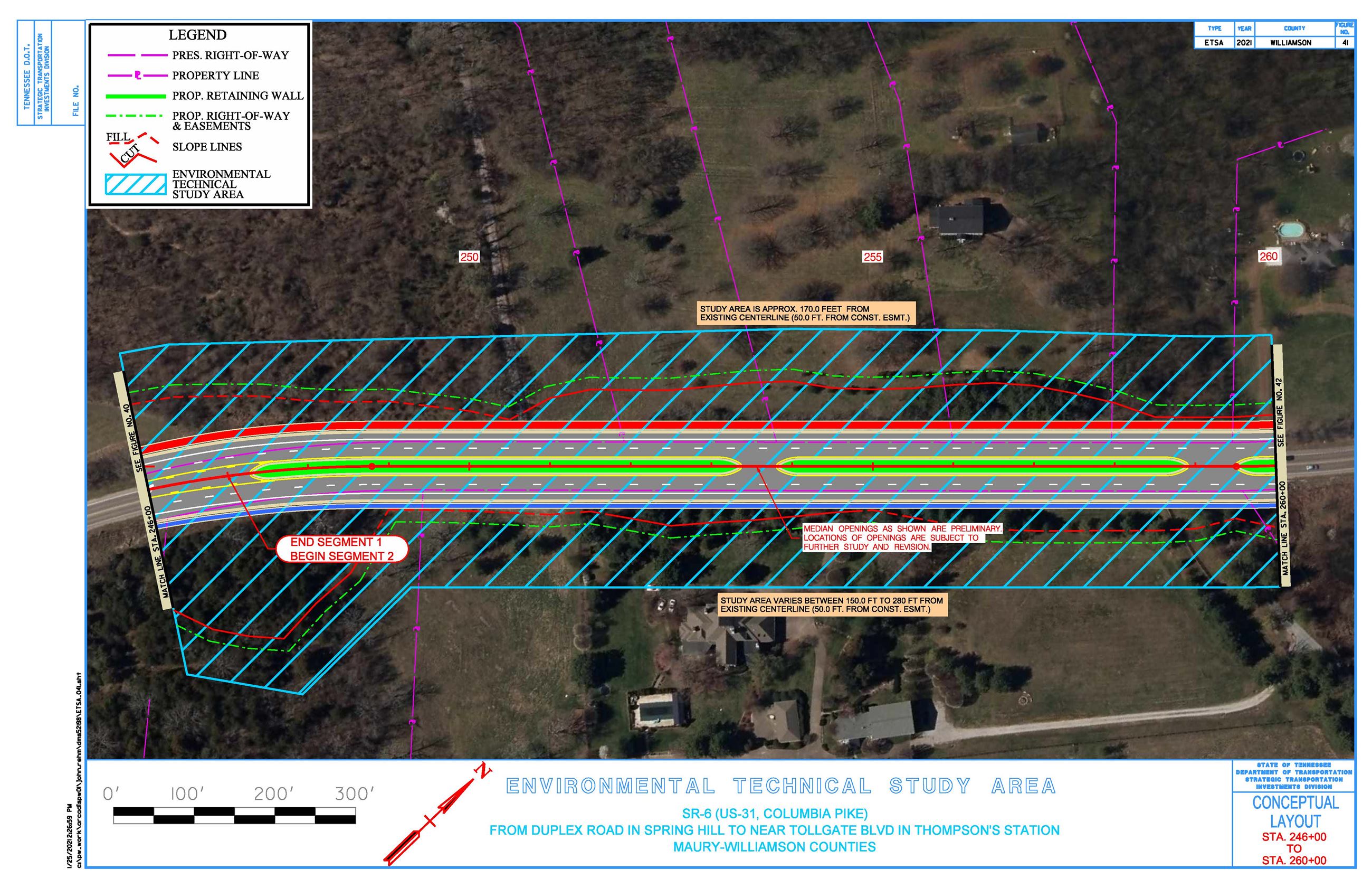
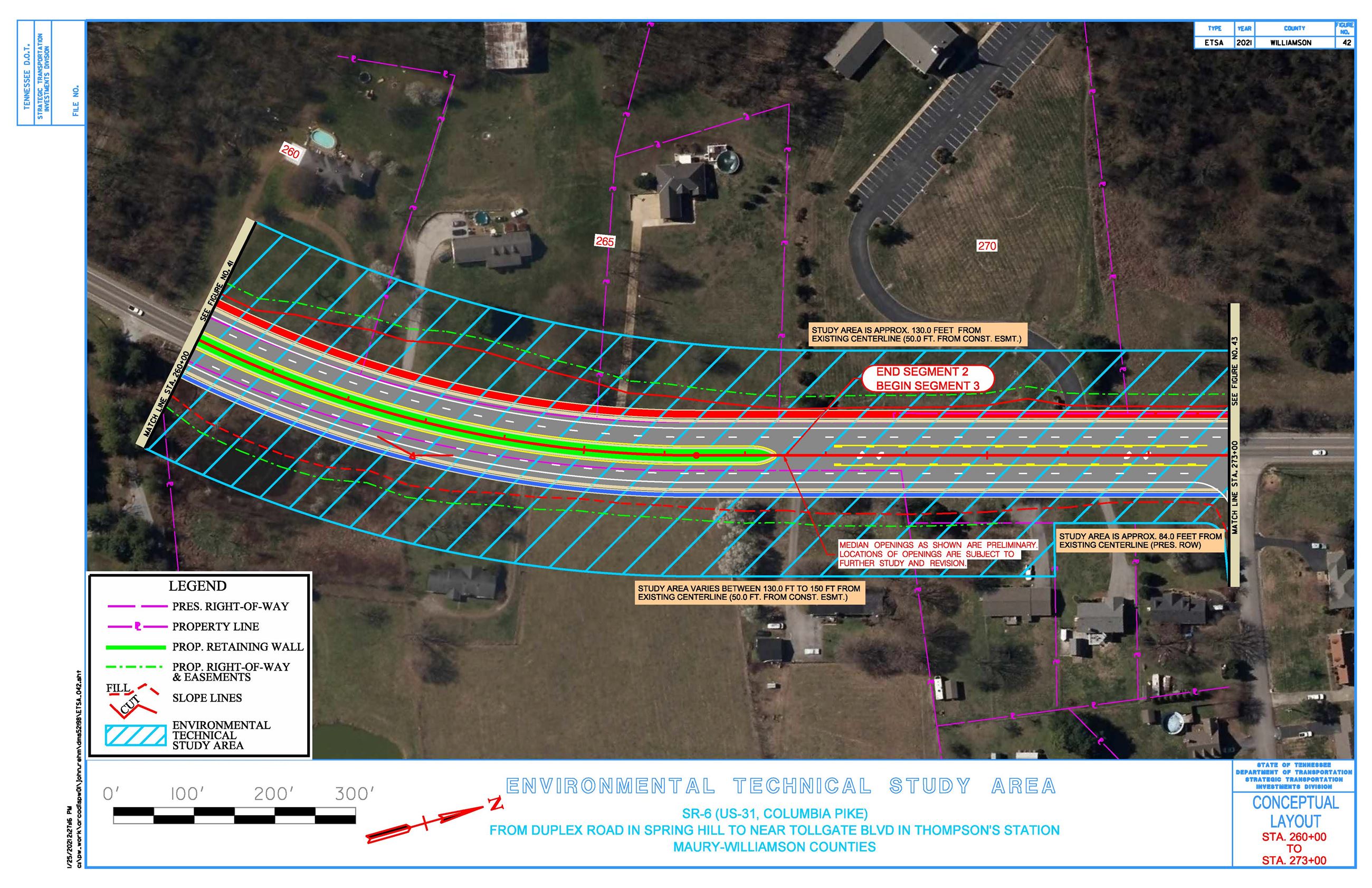
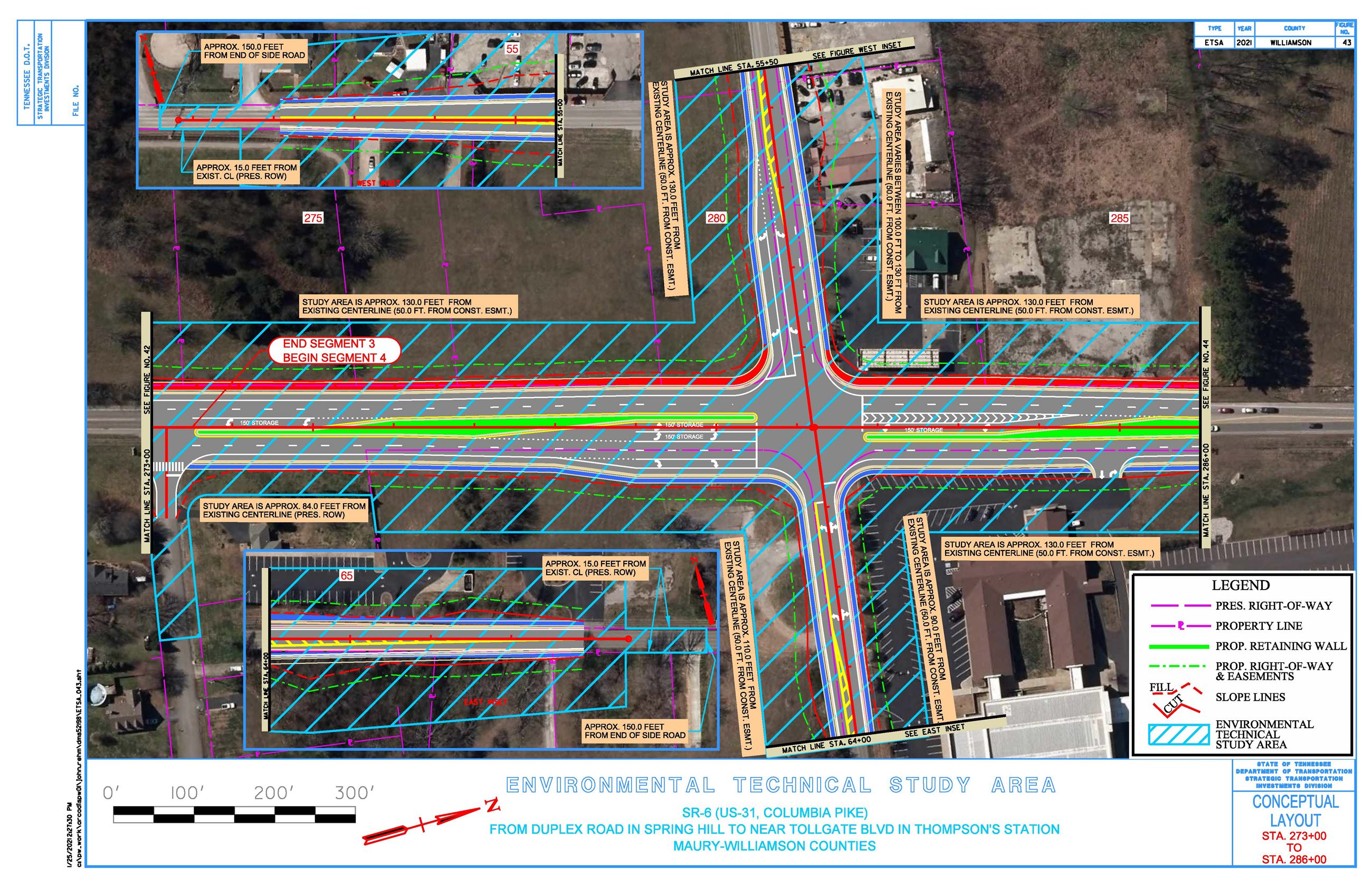
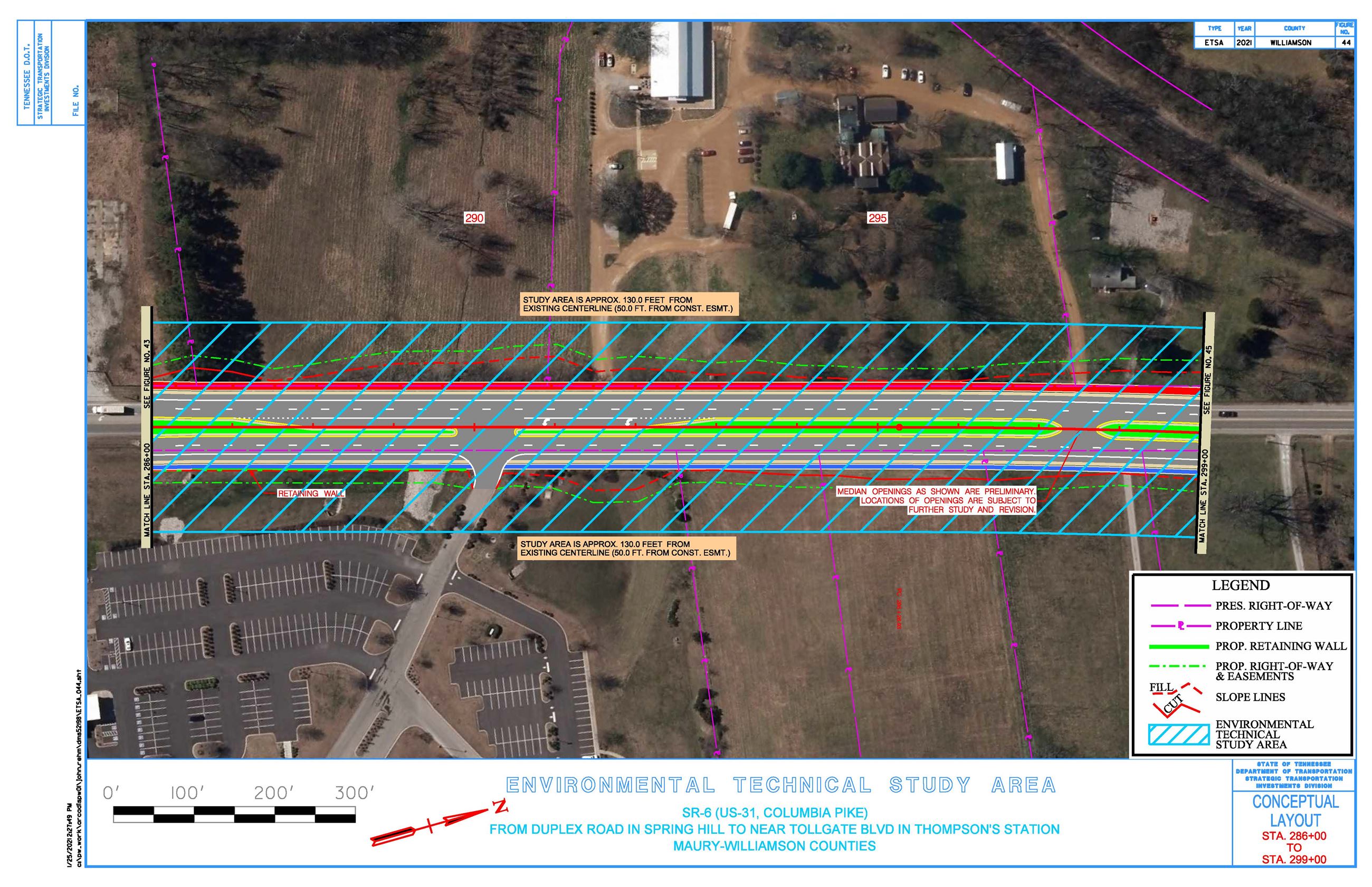
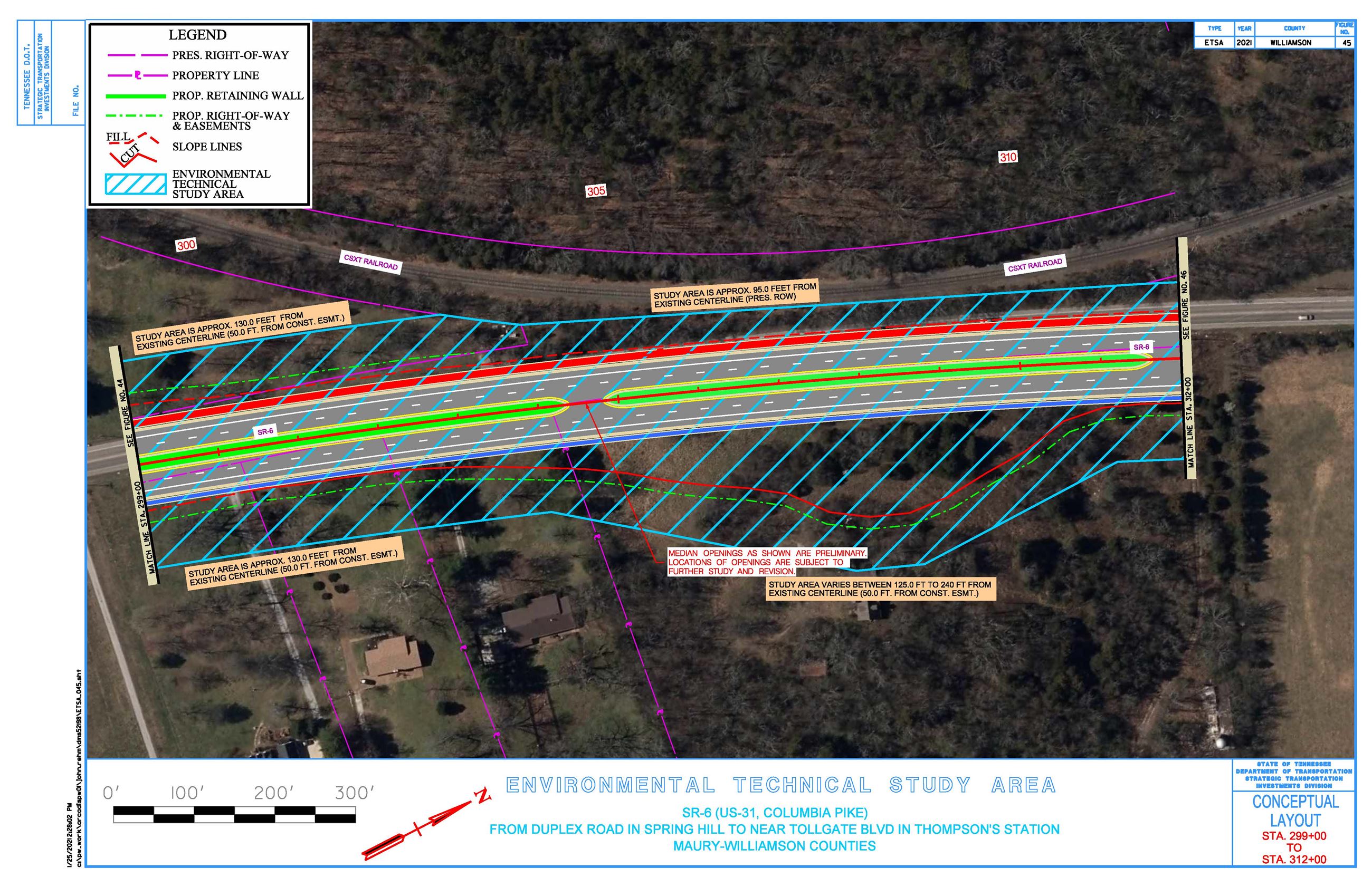
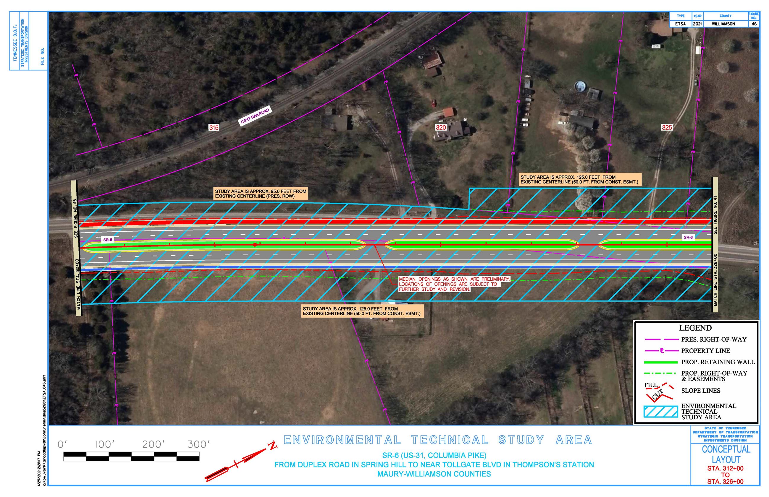
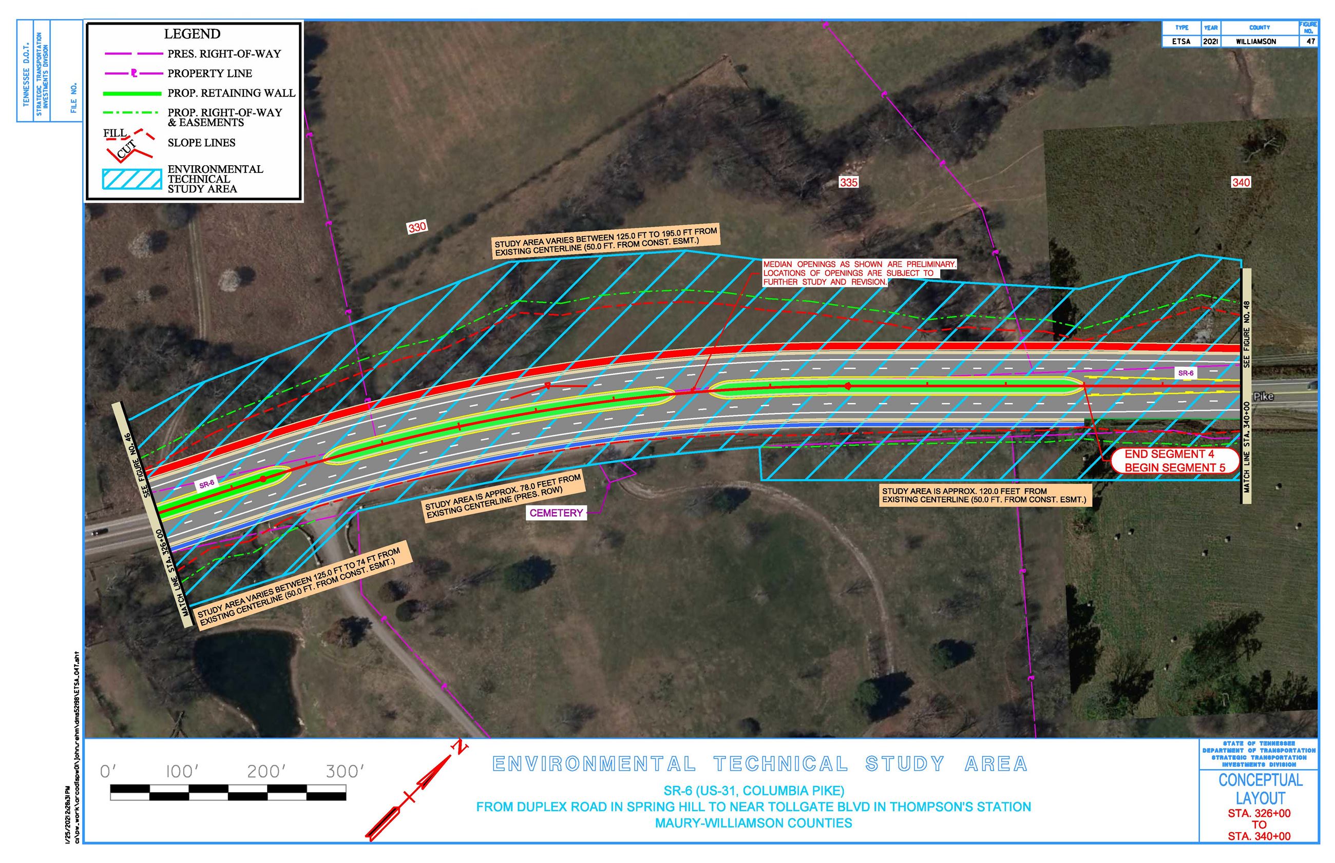
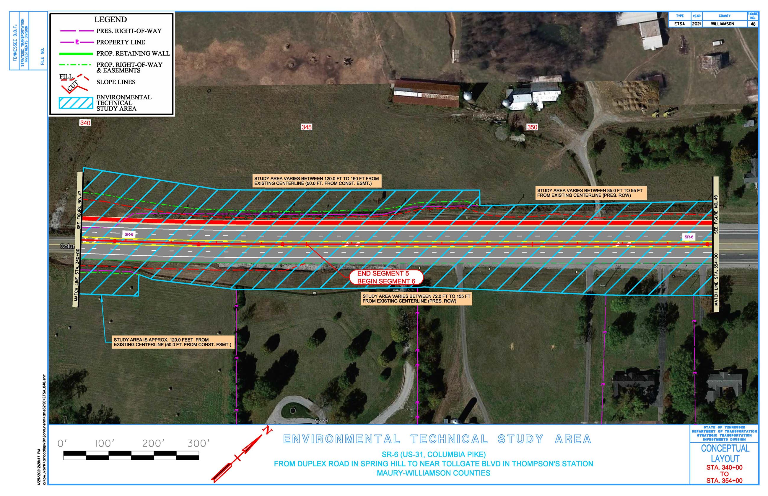
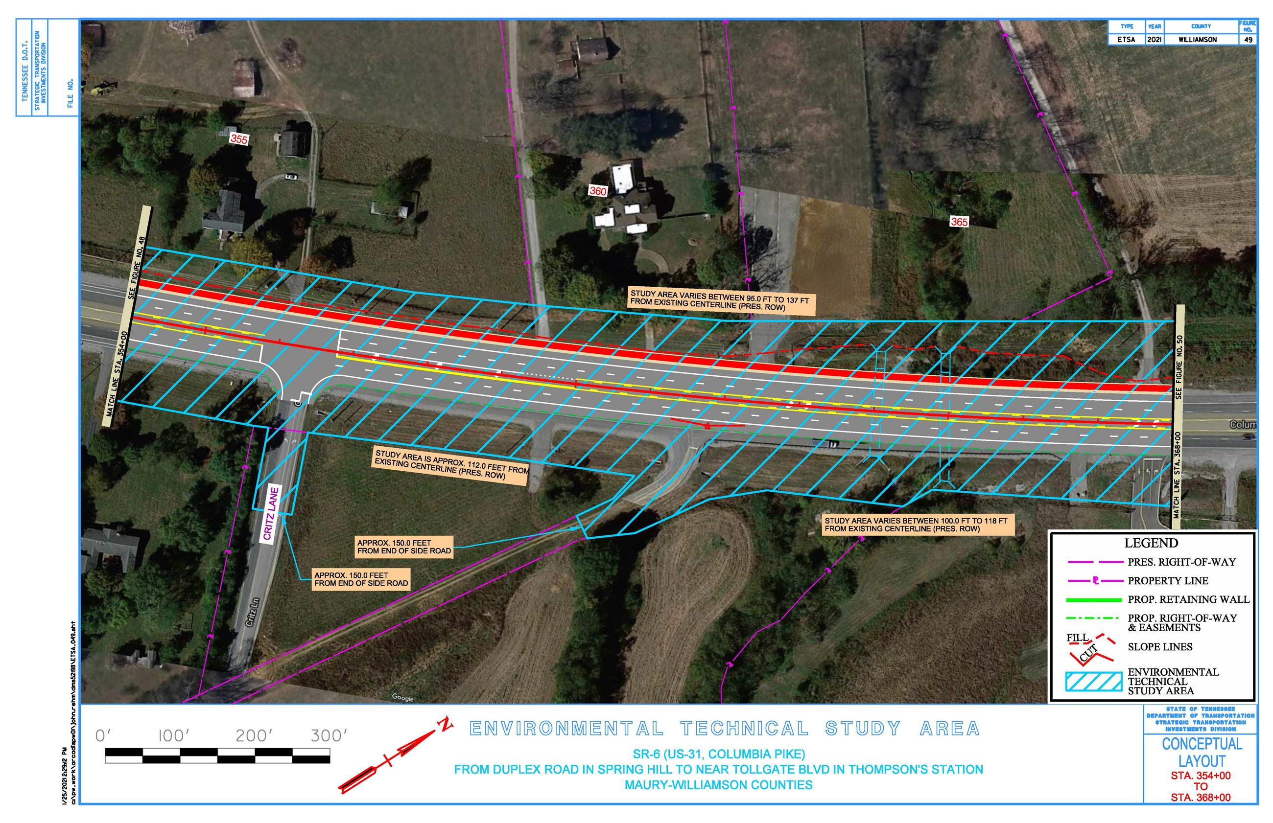
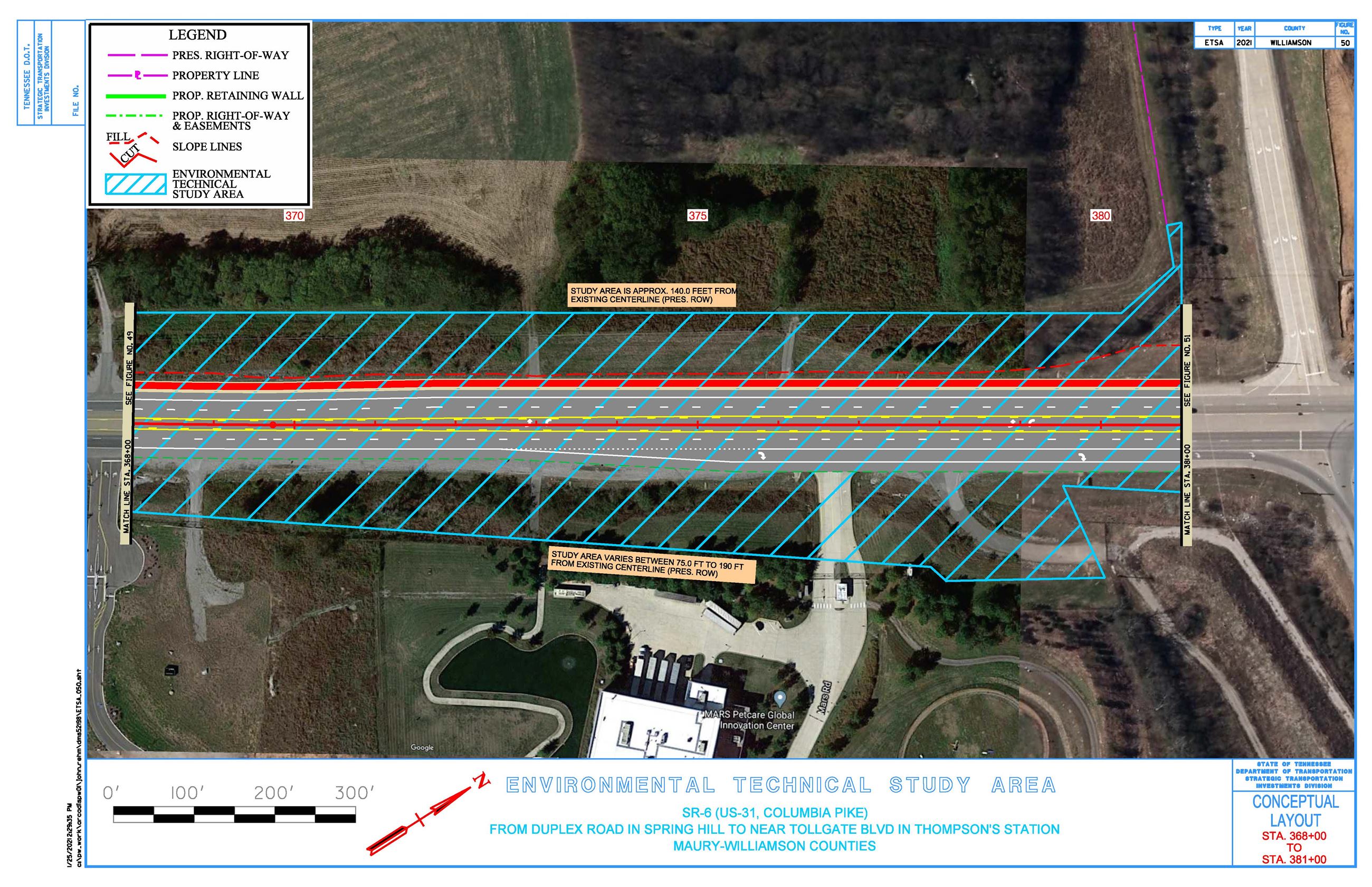
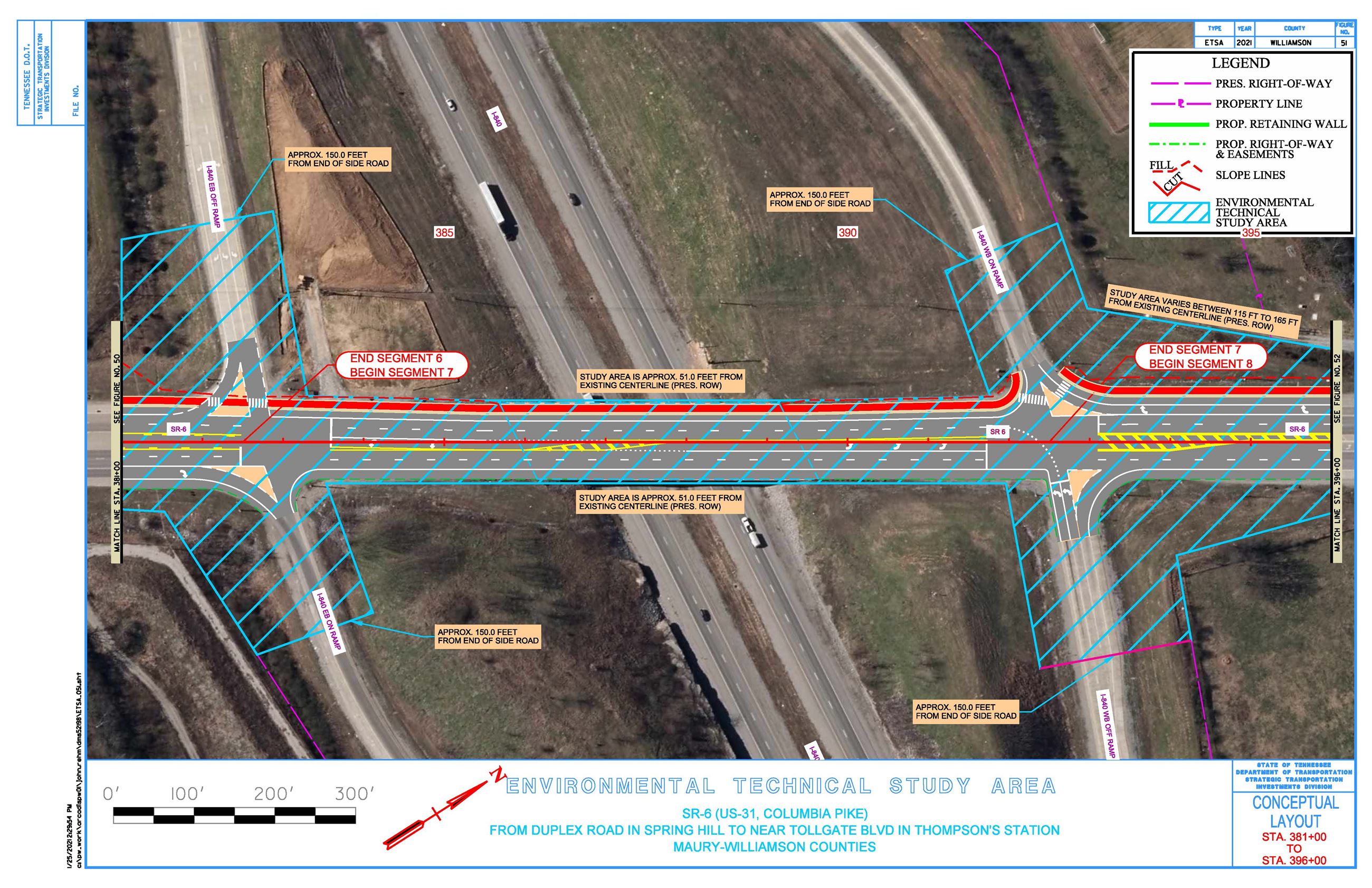
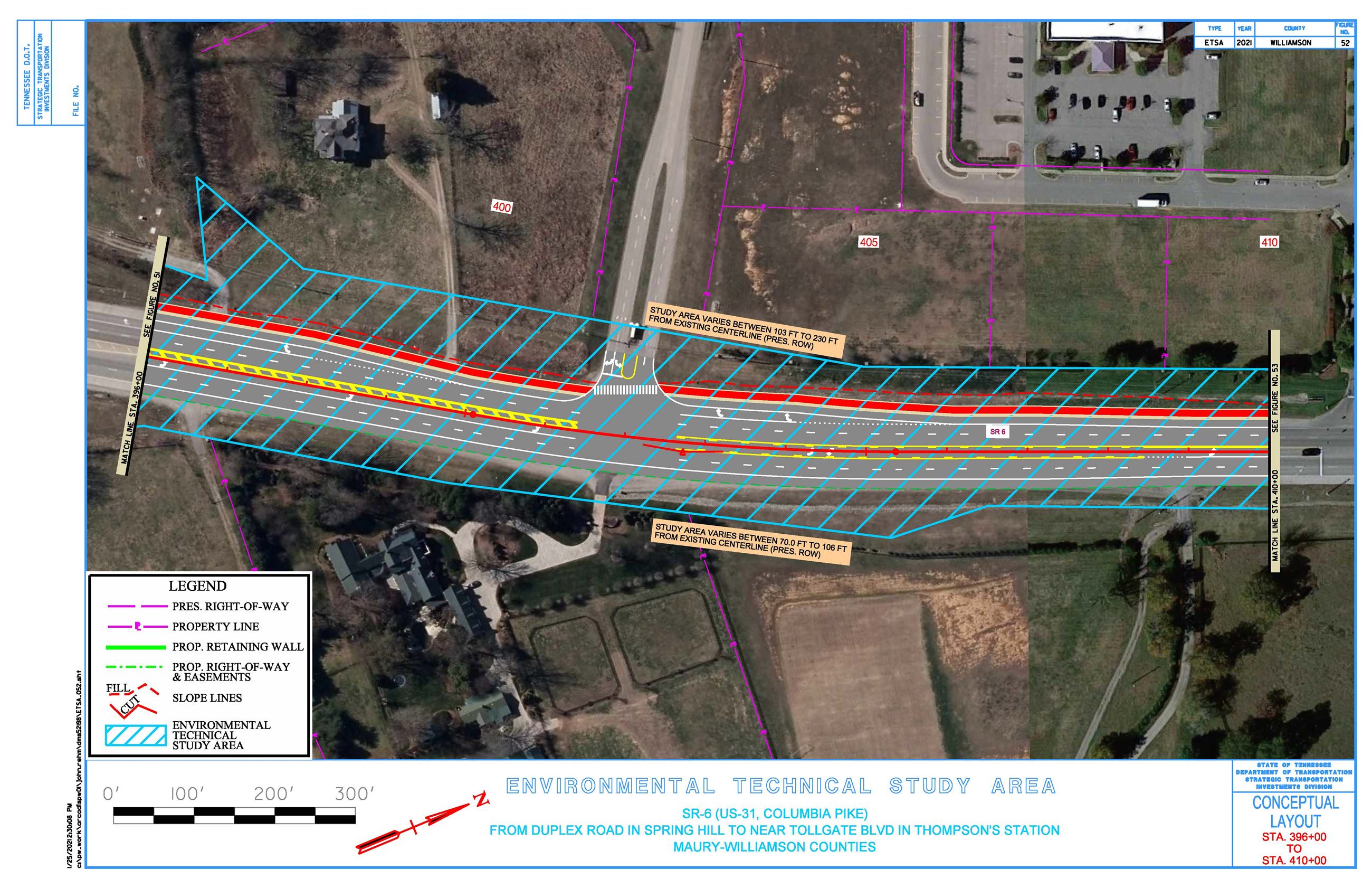
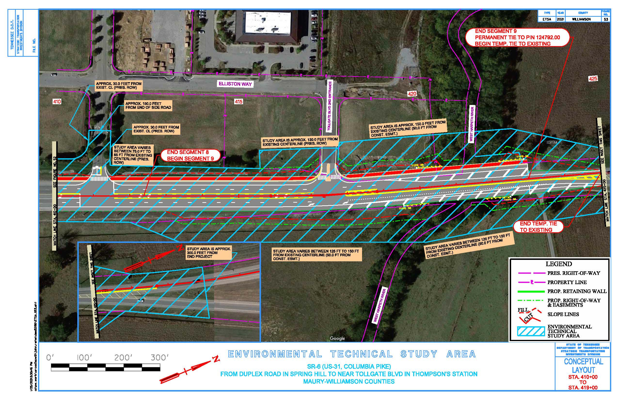
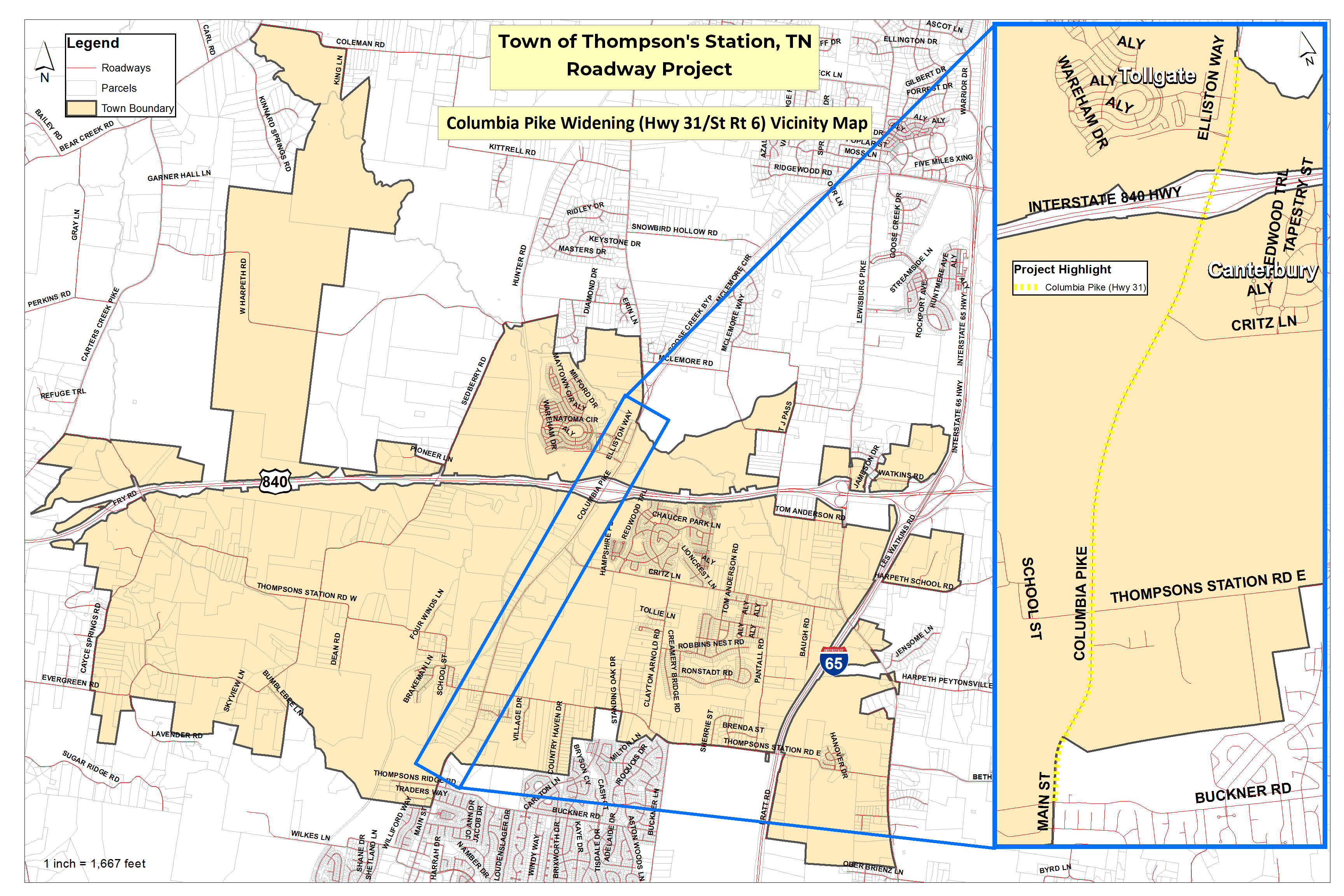
State Route 6, also known as Columbia Pike, Highway 31 and Main Street in Spring Hill, has been identified by the Tennessee Department of Transportation as an area that needs to be addressed due to the continuing population expansion in Middle Tennessee. TDOT has come up with concept plans for the widening of Hwy 31 to 4 lanes starting in Franklin and extending south through Thompson's Station and into Spring Hill. (See the vicinity map for location info.)
This is a State of Tennessee Department of Transportation project and this page will be updated as information is provided. The project is currently in the preliminary planning phases with construction not expected to start for another 3-5 years.
Thompson's Station is located in TDOT Region 3, District 37. TDOT personnel representing that area are listed below:
| Director of Operations: | Director/Assistant Chief Engineer: | Director of Project Development: |
|---|---|---|
| Mike Brown, P.E. (615) 350-4305 Mike.Brown@tn.gov | David Layhew, P.E. (615) 350-4300 David.Layhew@tn.gov | Shane Hester, P.E. (615) 350-4300 Shane.Hester@tn.gov |
You can also find local information on TDOT maintained highways at https://www.tn.gov/tdot/find-local-information.html including phone numbers for specific departments (eg. Survey & Design; Right-of-Way & Utilities; Bridge; Traffic; Community Relations; etc.)
The slideshow below is the concept design for Hwy 31 widening prepared by TDOT and includes only the sections within Thompson's Station Town Limits, from Buckner Rd to the Tollgate North Entrance.